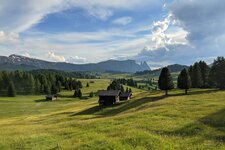
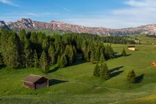
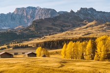
This hike on the Alpe di Siusi high plateau will delight you with great views
Image gallery: Panoramic hiking tour on the Alpe di Siusi


The Alpe di Siusi high plateau is characterised by some elevations from where you will enjoy an enchanting panoramic view of the surrounding landscape. This circular hike takes us to Monte Piz and to the Giogo. We start at the station of the Alpe di Siusi cable car from where we initially follow path no. 30 to the crossroads at the Hotel Steger-Dellai. There, we continue walking along the paved path no. 3. We arrive at a crossroads where we take path no. 6 (then 6A) which climbs up to Monte Piz.
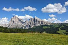
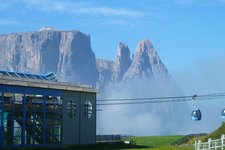
At the station of the Ortisei cable car we enjoy a stunning view of the Odle group and the Seceda in the north, the Sassolungo (Langkofel) and Sassopiatto (Plattkofel) in the east and the Sciliar massif with its extensive meadows in the south. We stop for a coffee break and then descend towards Saltria at 1,680 m a.s.l. the lowest point of our hike.
We follow the signs for path no. 30 and head towards Compaccio (Compatsch) until we arrive at a crossroads where we take path no. 6 towards "Panorama". At the Giogo (Jochberg, mountain station of the Panorama chair lift at 2,009 m a.s.l.) we enjoy an all-round panoramic view of the surrounding mountains. Path no. 7 takes us back to our starting point in Compaccio.
Author: AT
Date of the hike: 25 June 2010
Last updated in: 2026
-
- Starting point:
- Compaccio (mountain station gondula lift Alpe di Siusi)
-
- Overall time:
- 04:40 h
-
- Total route length:
- 15,8 km
-
- Altitude:
- from 1.680 m to 2.017 m
-
- Altitude difference (uphill | downhill):
- +546 m | -546 m
-
- Route:
- Compaccio - Mt Piz - Saltria - Giogo - Compaccio
-
- Signposts:
- 30, 6, 6A, 9, 30, 6, 7
-
- Resting points:
- Contrin Schwaige, Mont Seuc, Schgaguler Schwaige, Saltria, Panorama
-
- Recommended time of year:
- Jan Feb Mar Apr May Jun Jul Aug Sep Oct Nov Dec
-
- Download GPX track:
- Panoramic hiking tour on the Alpe di Siusi
If you want to undertake this hike, we recommend checking the weather and trail conditions in advance and on site before starting this hike!