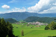
This circular hike takes us to the village of Tagusa overlooking the entrance to the Val Gardena
Image gallery: Hiking tour from Tisana to Tagusa and Castelrotto


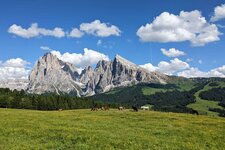
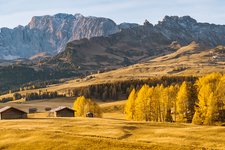
Our hike starts in Tisana, a small village west of Castelrotto. The paved path to Tagusa, a hamlet of the municipality of Castelrotto leads through meadows and forests. It is mid-October and autumn has already coloured nature in yellow, brown, red and orange tones. After about one hour of hiking and enjoying the stunning panoramic views of the Valle Isarco and the villages of Barbiano and Villandro, we arrive in the village of Tagusa.
Here, you can visit the wonderful church, as well as the School Museum where objects from ordinary school days in the small villages of the region are exhibited.
After this truly interesting time travel we take path no. 2A entering a dense forest. After a short stop at Maso Tamines, our itinerary initially proceeds along a narrow descent to the Valle Brembach (Rio Brem), then we ascend path no. 10 towards the village of Castelrotto. This final climb is the most demanding one of the entire hike. From the centre of Castelrotto it is a 20-minute hike back to our starting point in Tisana (paths no. 15A or 1).
Information: the Tisana-Tagusa section runs along a paved, low-trafficked road and is therefore suitable for baby carriages as well.
Date of the hike: 13 October 2010
Last updated in: 2026
Author: AT
-
- Starting point:
- Tisana near Castelrotto
-
- Overall time:
- 03:05 h
-
- Total route length:
- 12,5 km
-
- Altitude:
- from 927 m to 1.143 m
-
- Altitude difference (uphill | downhill):
- +459 m | -459 m
-
- Route:
- Tisana - Tagusa - Tamines Farm - Brembach valley - Castelrotto - Tisana
-
- Signposts:
- 1, 2A, 10, 15A
-
- Recommended time of year:
- Jan Feb Mar Apr May Jun Jul Aug Sep Oct Nov Dec
-
- Download GPX track:
- Hiking tour from Tisana to Tagusa and Castelrotto
If you want to undertake this hike, we recommend checking the weather and trail conditions in advance and on site before starting this hike!