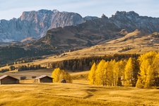
This pleasant walk takes us to the Königswarte panoramic point
Image gallery: Hiking tour along the Laranza circular trail


Today's hike starts from the small hamlet of Telfen on the road between Castelrotto and Siusi. The initial, paved section soon turns into a forest path leading to the Königswarte, a panoramic viewpoint dedicated to King Frederick Augustus III of Saxony and main attraction of this tour. The first stretch runs along a paved road which soon turns into a forest path to the Königswarte. This panoramic viewpoint, which owes its name to King Frederick August III, is the highlight of this excursion. The Frederick August path on the Alpe di Siusi is dedicated to the same king.
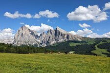
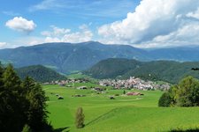
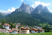
Below us, we see the Weissenbach gorge where the ruins of Castle Rovereto in Sant'Osvaldo and the Santa Verena church on the opposite site of the Valle Isarco stand. The view of the entire Renon high plateau and the Sciliar and in case of good weather of the Ortles and the Oetztal Alps is simply amazing.
If you would like to learn more about forests you can follow the signpost to the mushroom path, a 1-km long itinerary. This pleasant circular hike is perfectly suitable for families with children thanks to its minimal elevation gain and the well-maintained paths it leads along. It can be made in all seasons except winter.
Author: AT
Date of the hike: 19 August 2010
Last updated in: 2026
-
- Starting point:
- Telfen near Castelrotto (the tour can also be started in Siusi or Castelrotto village)
-
- Overall time:
- 01:25 h
-
- Total route length:
- 5,6 km
-
- Altitude:
- from 1.074 m to 1.170 m
-
- Altitude difference (uphill | downhill):
- +117 m | -117 m
-
- Signposts:
- "Rundweg Laranz", 5A, 5B, 5
-
- Resting points:
- Bürgerstube restaurant
-
- Recommended time of year:
- Jan Feb Mar Apr May Jun Jul Aug Sep Oct Nov Dec
-
- Download GPX track:
- Hiking tour along the Laranza circular trail
If you want to undertake this hike, we recommend checking the weather and trail conditions in advance and on site before starting this hike!